How To Hike Fangs Pass

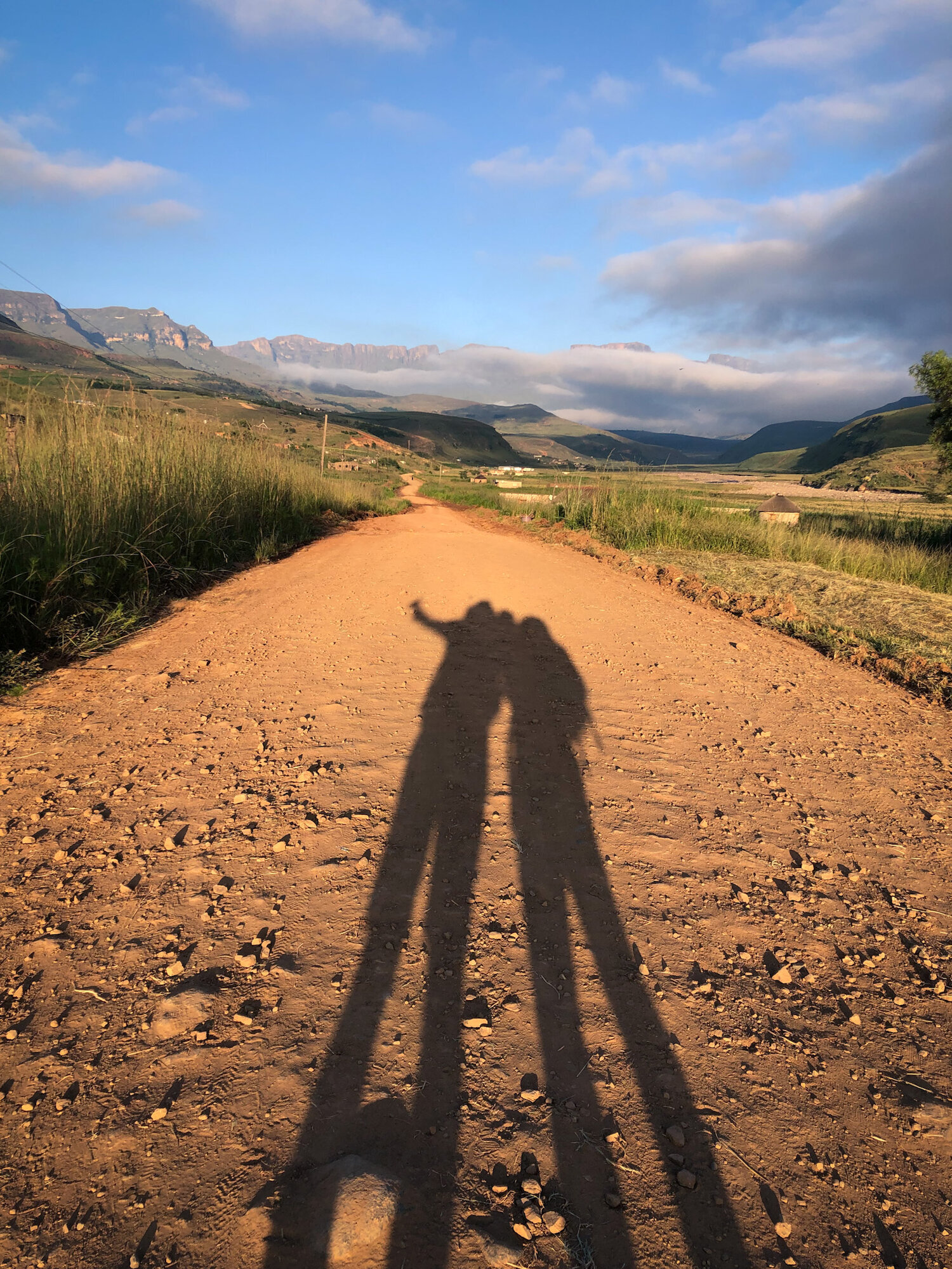
Fangs Pass is one of the more striking passes in the Berg. It’s a dramatic, rugged and rewarding hike. For landscape photography, Fangs Pass is an excellent choice. Not only is the base camp spectacular, but upon reaching the top you will be in an ideal position to photograph The Madonna and Her Worshippers, the Mnweni Pinnacles, as well as the Mnweni cutback region. In the article to follow, I'll share my advice on how to hike Fangs Pass, along with approximate distances.
PLEASE READ THIS FIRST:
Please ensure you hike within your limits. Weather can change rapidly and be life-threatening. Always carry warm and waterproof clothing, sufficient food and water, a map, a charged cellphone, a headlamp and a basic first aid kit. Ensure the entire group has saved the relevant emergency numbers for the area you are hiking in. These are the people you call for help: not your mom, sister, or best friend. All distances, elevations, and time are tracked with my Garmin watch. Your own experiences may vary. Please be sure not to rely on GPS navigation, and ensure you have a decent topographical map, and the knowledge to use it.
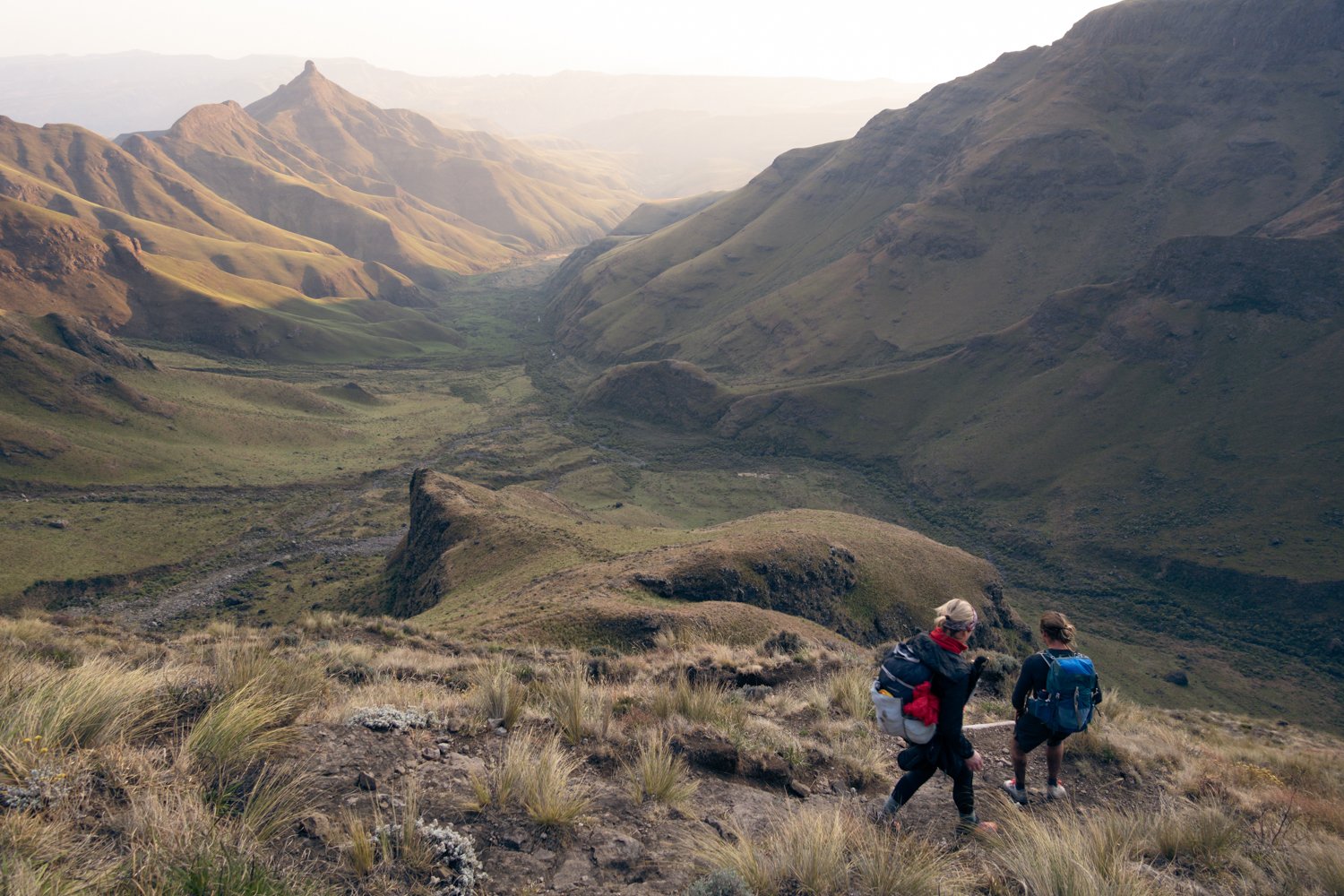
Day 1: Mnweni Cultural Centre to the base of Fangs Pass
Distance: 14.40km
Time: 5 hours
Altitude gain: 815m
Difficulty: Easy walking with a gradual altitude gain
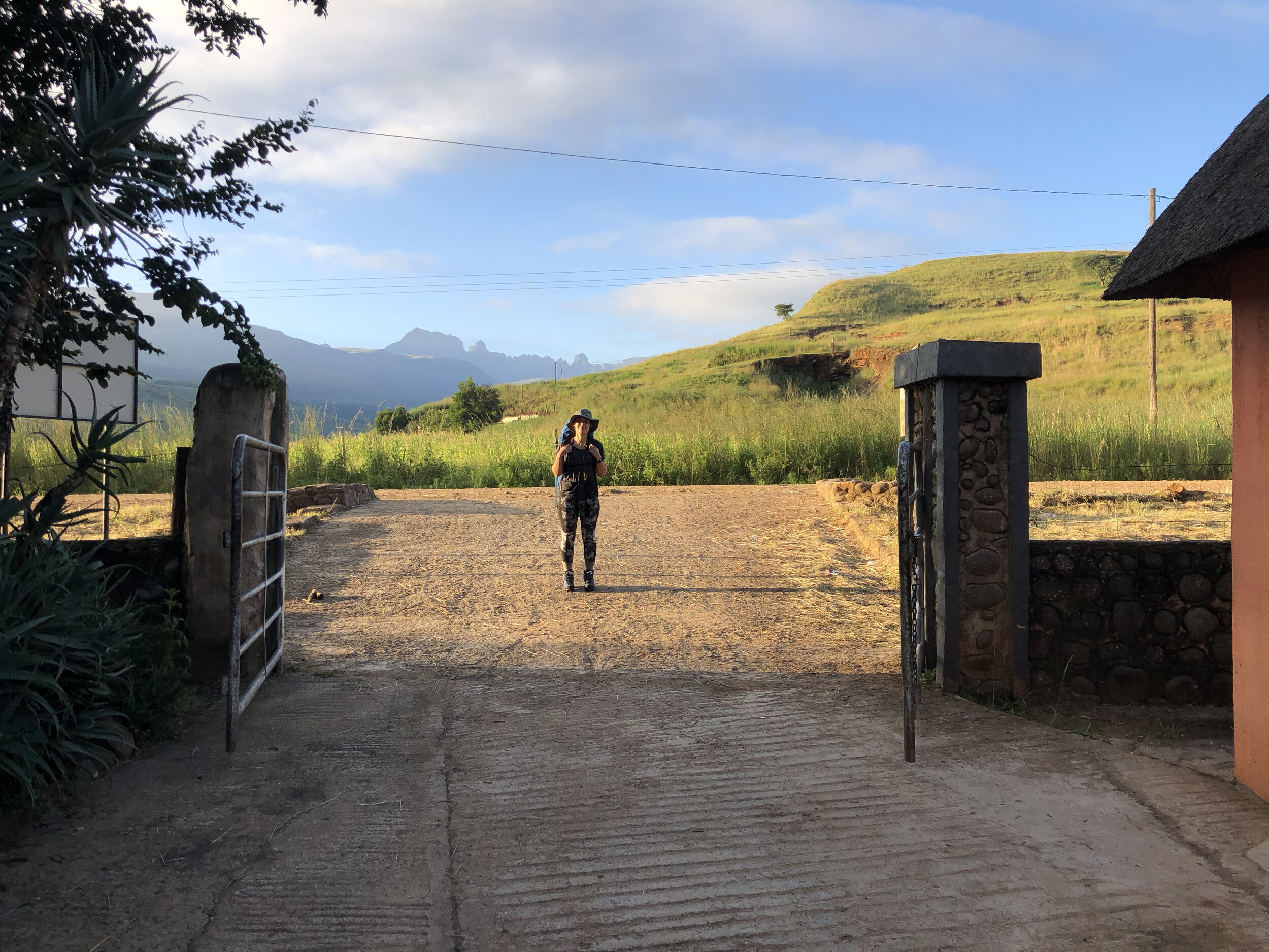
Start at the Mnweni Cultural Centre
The Mnweni Cultural Centre is the starting point for numerous routes in this region, and Fangs Pass is one of them. Click here to read my post about the Mnweni Cultural Centre. You will need to sign the mountain register at MCC as well as pay your hiking fees, R60 per person per night on the mountain.
Formalities out of the way, your next step is to organise a lift to the end of the gravel road, just before the concrete bridge. This is where the actual hiking begins, and locals know the spot. Finding a lift saves you about 5km, and is easy enough to arrange by asking at the Mnweni Cultural Centre, or calling ahead. Budget around R50-R100 for this ride, dependent on your haggling skills. The distance above is from the Mnweni Cultural Centre, without a lift.
Over the hills and into the Mnweni Valley.
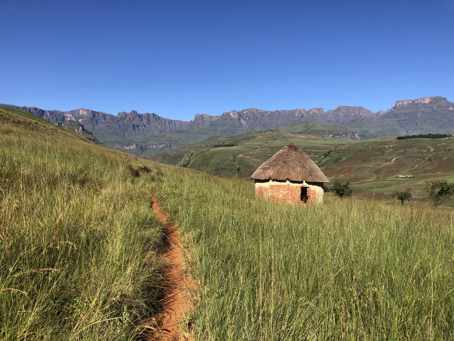
The trail to Fangs Pass begins on the same route as one would take to Icidi or Mnweni. You will find the path to the left of the main gravel road, just before a concrete bridge. Locals know it well and will be happy to point it out. The path winds its way above the road, through local homesteads toward the Mnweni valley. Expect to meet smiling shepherds and their cattle along the way, but give the dogs a wide berth.
Follow the map... and the river.
After passing through a final farm gate (be sure to close it behind you), you’ll be greeted by the expanses of the Mnweni valley, with the Mnweni river carving its way through the centre, and Mbazibale standing tall dead ahead. The Mnweni River will be your main navigational guide, and for the most part, the trail follows loosely alongside it. (Update 2021: Recent flooding has dramatically widened the river, and we hiked in the riverbed for much of the time in the valley).
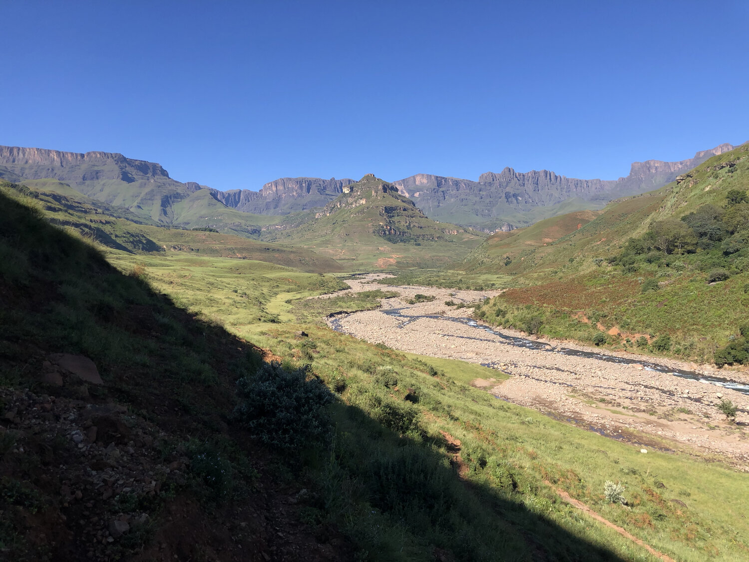

The Mnweni River flowing steadily after decent summer rains. March 2021.
Navigating to the base of Fangs Pass.
Shortly after entering the Mnweni Valley, you will cross the Ndeda River. Here, the trail makes a fork. Stick to the right, always keeping to the low ground alongside the river. There are numerous cattle paths in this area, which can easily lead you off course. As a rule of thumb, as long as you're heading upstream (in a southerly direction) you’re going the right way.
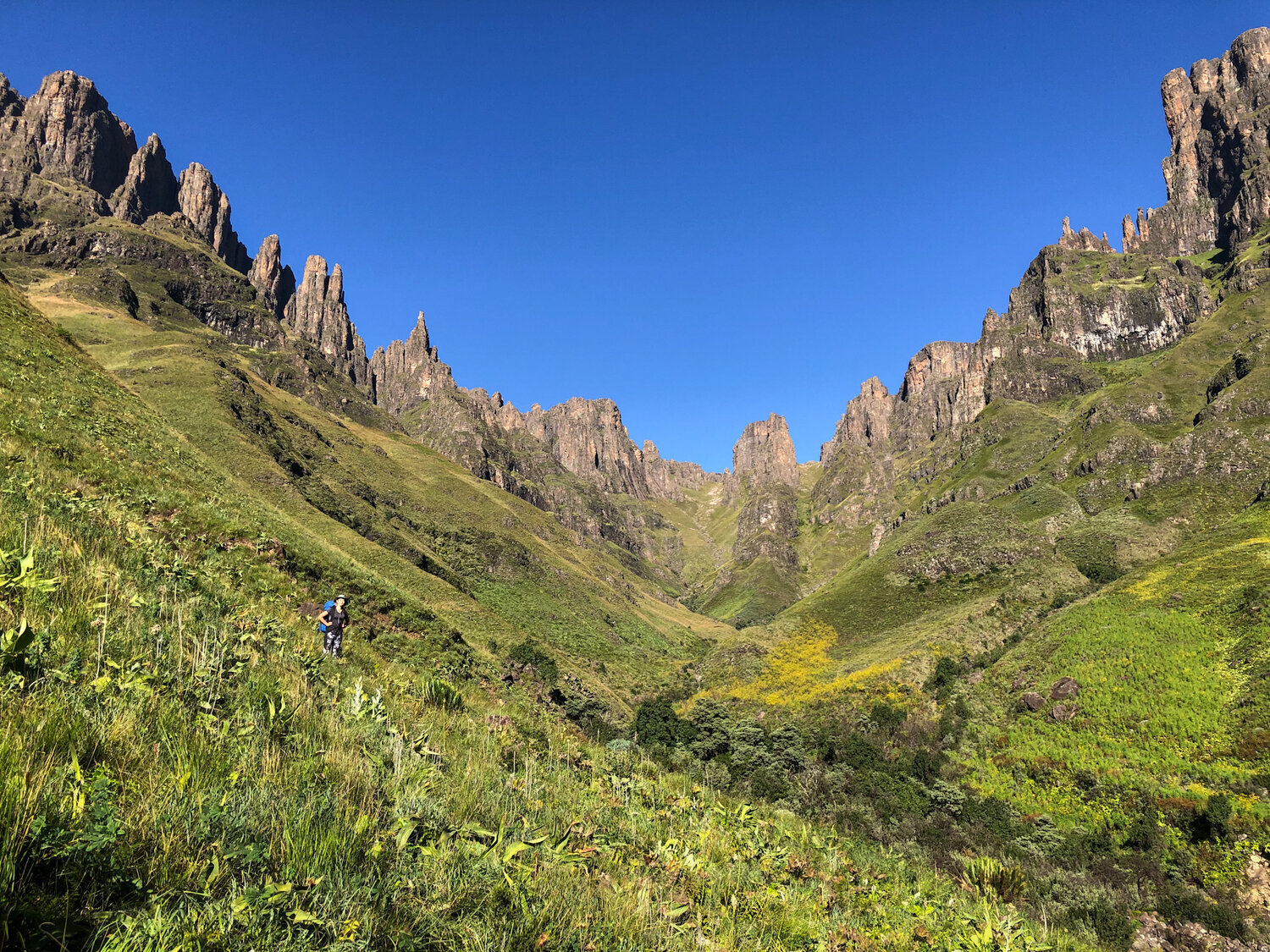
Take careful note of the valleys that pass you by, particularly in poor weather. First, you will pass the Icidi Valley on your right-hand side. At the next major river junction, the Mnweni Cutback will be ahead of you. To your right, is the Mubudini River, which will lead you up to Fangs Pass.
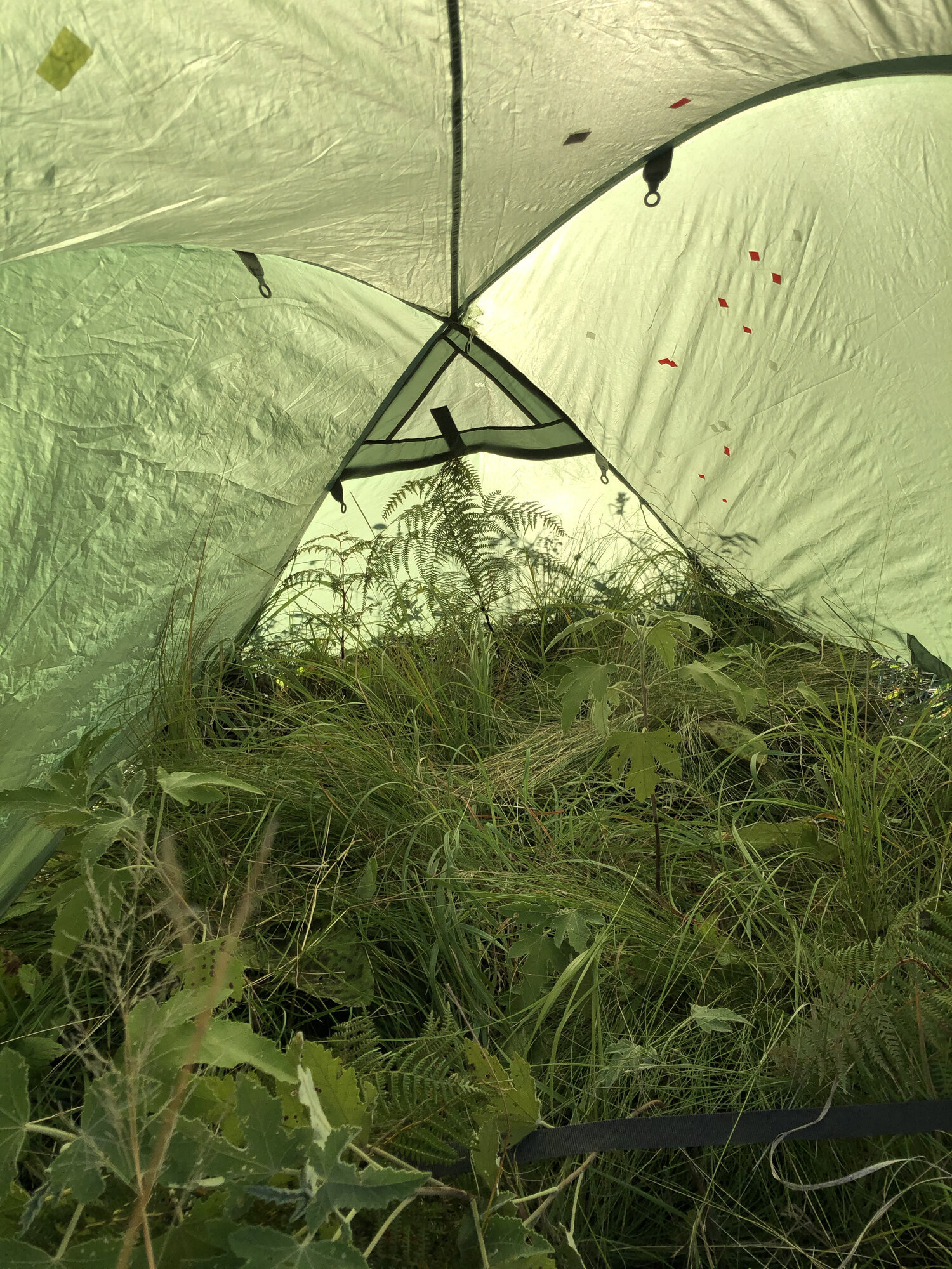
The final approach is along a beautiful section of trail, with lush vegetation flanking the path, as you make your way gently uphill. Again, using the river as your main navigational guide, you’ll hike for around 3km until you find yourself at a small waterfall. The extent to which it flows will depend on the time of year you visit. You’ll know when you’ve arrived because ahead of you is the iconic Madonna and Her Worshippers. Cross the river, and you will find acceptably flat ground to pitch your tent for the night. In summer, it can be rather overgrown. Be sure to camp well clear of the trail, and follow Leave No Trace principles.
The bottom is as good as the top.
For photographers, in particular, it is certainly worth spending a night at the base of Fangs Pass. Looking up at the pass, the sun will rise behind you, illuminating the rugged, dramatic peaks and filling the valley with soft golden light. In summer, thanks to the rain, the hillsides are a vibrant green, rich with brightly coloured flora and the rivers in full flow. These conditions make for excellent photography, and I would recommend hiking to the base, even if you have no intention of hiking up the pass itself.
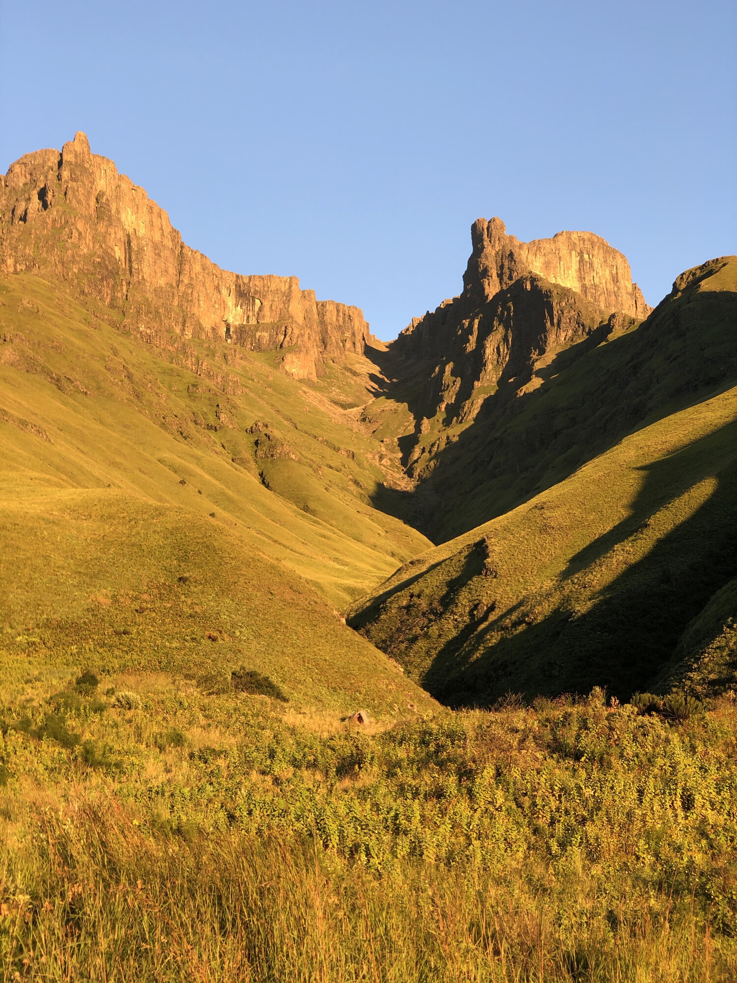

This is the river that will guide you to the top. Fangs Pass, 2021.

Fangs in flow. March 2021. Sony A7riii + NISI 15mm f4
Day 2: Ascending Fangs Pass
Distance: 4km approx
Time: 4 hours
Altitude gain: 1031m
Difficulty: Highly strenuous with sections of boulder hopping scrambling, and steep grassy hillsides.
Finding the trail
Fangs Pass itself is only around 4km in length, but what it lacks in distance it makes up for in boulders and bushwhacking. On a standard 1:50 000 scale Drakensberg Map, there is not enough detail to precisely identify where the path lies. On these maps, the path is described on the left (true right) of the river. In reality, this path seems to often wain and disappear, and I’ve found it can be easier to boulder hop up the river, than to battle through the bush alongside it. Indeed some sections of the hillside are impassable, and the river is the only option. Generally speaking, on your ascent you should either be on the river's left or in the river bed.
Take caution in the riverbed
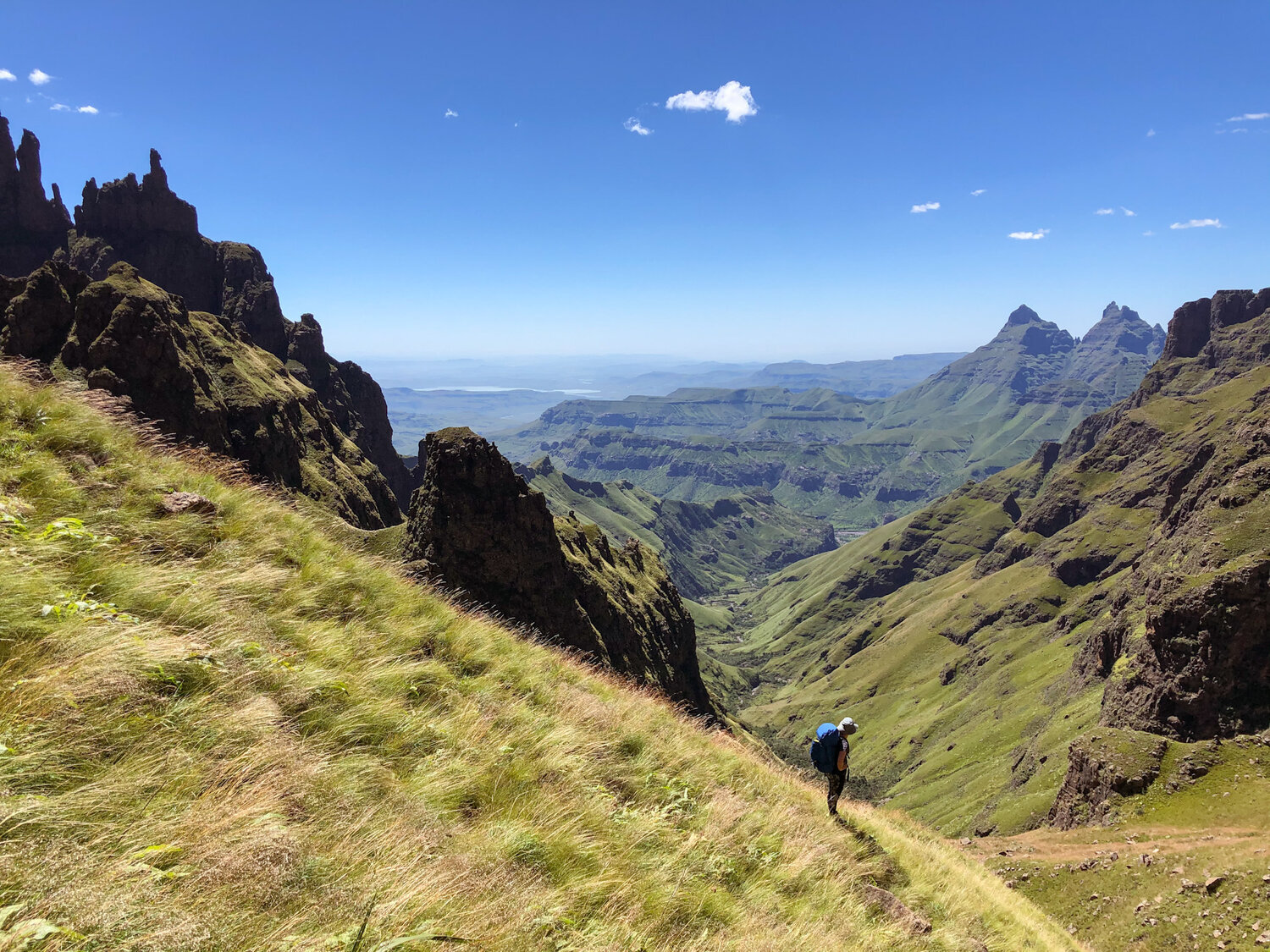
In rainy weather (summer), you should take extreme care when boulder hopping up the river. Wet rocks are hazardous, and floods can catch you off guard and pose a serious risk. Weather aside, as long as you are heading uphill, you’re heading the right way. There are no major detours once you're in the pass itself. Only a whole lot of climbing. Toward the top of the riverbed, you will need to navigate sections of steep rock, and caution should be taken. The final grassy slopes are incredibly steep, but nothing technical.
My advice for Fangs Pass is to leave the base early and take your time ascending. Stop regularly, admire the views, and enjoy the hike up.
Options for descending
You can descend Fangs Pass via the same route and either camp in the Mnweni Valley, or hike back to the Mnweni Cultural Centre. The latter will be a rather long day, about 8 hours.
Alternatively, if you have a few more days, go and explore. Once atop the escarpment, I would recommend heading in a northerly direction toward Rat Hole Cave, for an unrivalled view of The Madonna and Her Worshippers. From here, your choices are wide open.

Looking back down Fangs Pass. This is the final stretch to the top.
Let me show you the Drakensberg
Join one of our guided photography workshops with North Peak Photo Tours